Your cart is currently empty!
Britain’s Tudor Maps – County by County
£30.00
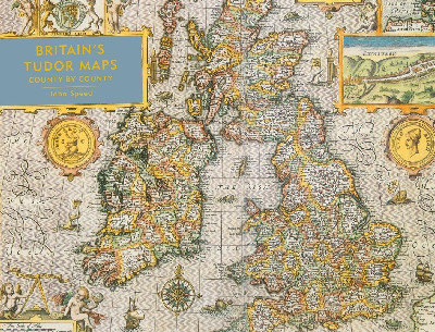
A stunning new edition of the earliest atlas of the British Isles, Britain’s Tudor Maps – County by County reproduces the maps of John Speed’s 1611 collection The Theatre of Great Britaine in large format for the first time. Contains 67 stunningly detailed maps in full colour alongside commentary from Alasdair Hawkyard.
Out of stock
Description
Argraffiad newydd, syfrdanol o’r atlas cyntaf o ynysoedd Prydain, sy’n atgynhyrchu mapiau o gasgliad John Speed The Theatre of Great Britaine o’r flwyddyn 1611, a hynny mewn diwyg mawr am y tro cyntaf. Cynhwysir 67 map manwl mewn lliw llawn ynghyd â sylwebaeth gan Alasdair Hawkyard.A stunning new edition of the earliest atlas of the British Isles, Britain’s Tudor Maps – County by County reproduces the maps of John Speed’s 1611 collection The Theatre of Great Britaine in large format for the first time. Contains 67 stunningly detailed maps in full colour alongside commentary from Alasdair Hawkyard.
Additional information
| Language | English |
|---|
Related products
-

1215 – The Year of Magna Carta
£5.00 -
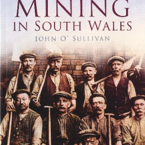
A Photographic History of Mining in South Wales
£14.99 -

A Rhondda Romance
£18.00 -

AA Leisure Guide: Wales
£9.99 -

Acts of God
£7.99