Your cart is currently empty!
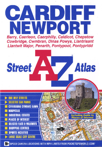
Cardiff and Newport A-Z Street Atlas
£5.95
A full colour street atlas featuring 107 pages of continuous street mapping that extends to include: Pontypridd, Caerphilly, Cwmbran, Pontypool, Caerleon, Penarth, Barry, Rhoose, Llantwit Major, Radyr, Pontyclun, Beddau, Taff’s Well, including a street index and guide to places of interest.
Out of stock
Description
Atlas stryd lliw llawn o drefi ardaloedd Caerdydd a Chasnewydd yn cynnwys Y Barri, Caerllion, Caerffili, Cil-y-coed, Cas-gwent, Y Bontfaen, Cwmbrân, Dinas Powys, Llantrisant, Llanilltud Fawr, Penarth, Pontypŵl a Phontypridd, ynghyd â mynegai stryd a chanllaw i fannau o ddiddordeb.A full colour street atlas featuring 107 pages of continuous street mapping that extends to include: Pontypridd, Caerphilly, Cwmbran, Pontypool, Caerleon, Penarth, Barry, Rhoose, Llantwit Major, Radyr, Pontyclun, Beddau, Taff’s Well, including a street index and guide to places of interest.
Additional information
| Language | English |
|---|