Your cart is currently empty!
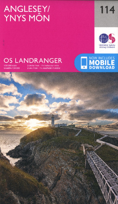
O.S. Landranger 114 Anglesey/Ynys Mon
£12.99
The perfect 1:50 000 (2 cm to 1 km) scale OS Landranger Map for a day visit or short break on the Isle of Anglesey, comprising information for tourists about rights of way, places of interest, picnic areas and camp sites, with some details in French and German. Now inlcudes mobile download.
Description
Map OS Landranger graddfa 1:50 000 (2 cm i’r cilomedr) addas ar gyfer ymweliad undydd neu wyliau byr i Ynys Môn, yn cynnwys gwybodaeth i ymwelwyr am lwybrau hawliau tramwy, mannau o ddiddordeb, llefydd picnic a mannau gwersylla, gyda rhai manylion yn Ffrangeg ac Almaeneg. Nawr â fersiwn digidol i fynd ar eich ffôn symudol.The perfect 1:50 000 (2 cm to 1 km) scale OS Landranger Map for a day visit or short break on the Isle of Anglesey, comprising information for tourists about rights of way, places of interest, picnic areas and camp sites, with some details in French and German. Now inlcudes mobile download.
Additional information
| Language | eng, wel |
|---|
Related products
-
2000 Plus Wales Map
£6.95 -

Brilliant Maps
£14.99 -

Dinky Map Aberdyfi
£3.99 -

Dinky Map Beddgelert
£3.99 -

Dinky Map Betws-y-Coed
£3.99